Lost hiker rescued from Red River Gorge cliff line- and it's happened before

– 3 min read
The Wolfe County Search and Rescue Team is stumped by repeat rescues at the same spot.
"I'm Shay McAlister, and this is Shay Informed: an independent, ad-free platform dedicated to honest journalism with compassion and clarity.
Are you new here? Sign up for the free newsletter or subscribe to support our mission.
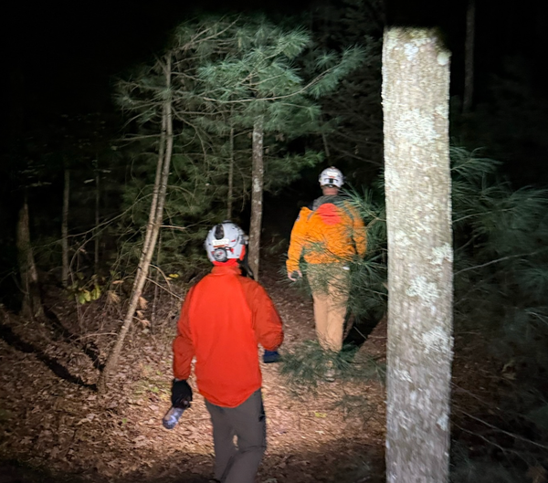
When darkness began settling over the Red River Gorge Tuesday evening, a woman who'd been hiking since early afternoon found herself stranded on a cliff line- cold, unprepared, and running out of daylight.
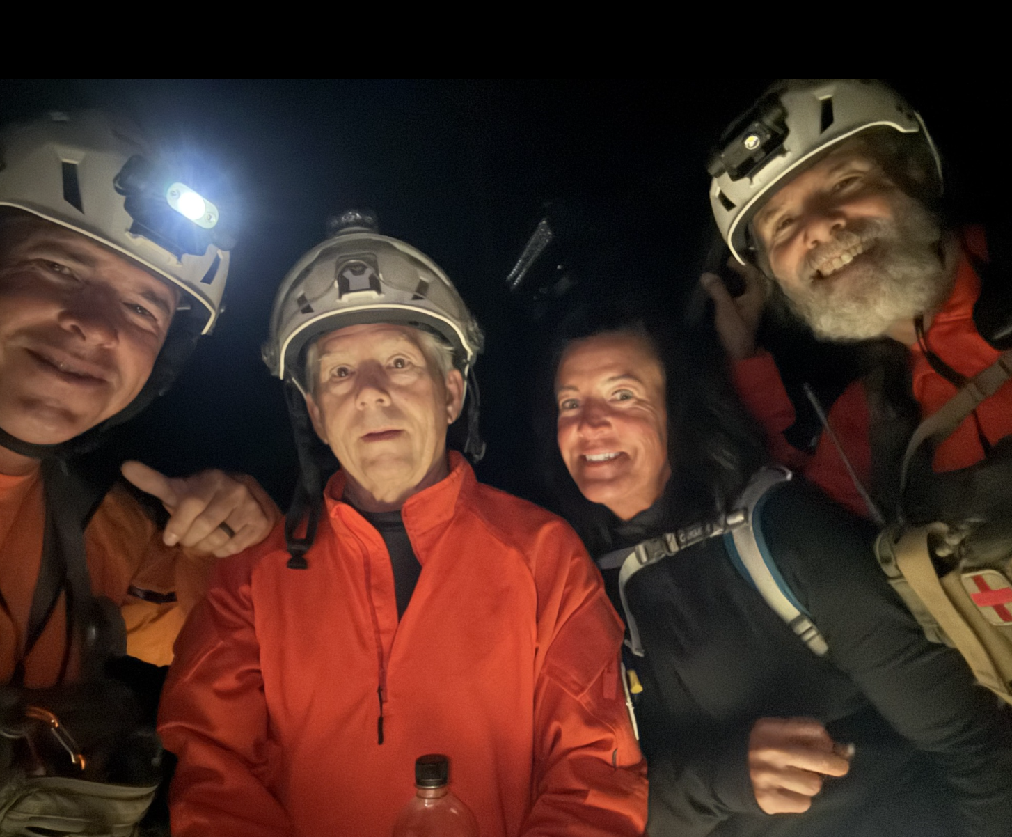
The Wolfe County Search and Rescue Team (WCSART) got the 911 call at 5:30 p.m. The hiker had entered the trail system around 12:30 p.m., expecting a few hours in the Kentucky wilderness. Nearly five hours later, she was stuck above the Sheltowee Trace and Gladie Creek with no clear way out.
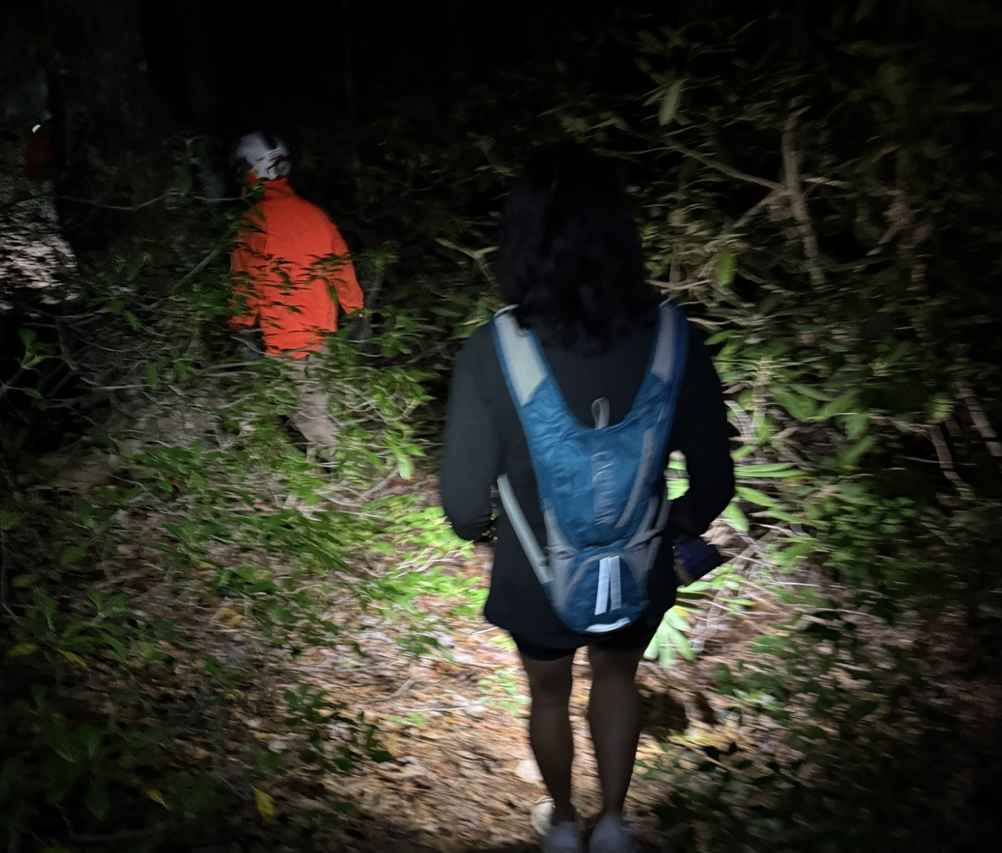
Rescuers quickly sent the woman a locator link to pinpoint her exact position, then mapped out their approach. The team decided the safest route was via Klaber Ridge, taking UTVs as far as possible before hiking about a mile to reach her. By the time they arrived, temperatures were dropping fast and night had fully fallen.
The good news? She was found uninjured and in good spirits- though extremely relieved to see her rescuers.
But here's where the story gets interesting: this is the second time in the past year that WCSART has rescued a lost hiker at almost this exact location.
"We are curious to hear public comment on how this might be occurring," the rescue team wrote in their incident report.
The hiker told rescuers she'd turned left on the Sheltowee Trace at the Bison Way intersection, but couldn't explain much beyond that about how she ended up where she did. Her clothing and shoes showed no signs of bushwhacking, suggesting she'd stayed on some kind of trail the entire time.
WCSART has a theory. They believe the hiker may have gotten off course near Indian Arch. Instead of turning south on the Sheltowee Trace, she likely turned north- toward the Frogs Head loop- and ended up on one of the unofficial "user trails" that crisscross the area.
There's a 1.4-mile section of trail heading north toward Klaber Ridge that could easily confuse hikers. The rescue team suspects that when the woman realized she was lost, she turned around and headed back south- but ended up on the wrong ridge entirely, essentially following the same route the rescue UTVs would later take to find her.
With two nearly identical rescues in the same spot within a year, WCSART is reaching out to the hiking community for insight. Is there confusing signage? An unmarked junction? A user trail that looks deceptively official?
"Let us know what you think," the team says.
For now, the hiker is safe and sound- a reminder that even experienced outdoors enthusiasts can find themselves turned around in the winding trails of the Red River Gorge, especially as daylight fades and temperatures drop.
If you're planning to hike in the area, make sure you're prepared for unexpected delays, carry navigation tools, and let someone know your plans. And if you have insights about this puzzling trouble spot, the rescue team would love to hear from you.
Like what you see? Learn more about Shay Informed here! This is honest journalism with compassion and clarity.