Severe storms possible Monday night into early Tuesday across Kentucky

– 2 min read
Time to pull out the weather radios, turn on push alerts, and charge those phones!
"I'm Shay McAlister, and this is Shay Informed: an independent, ad-free platform dedicated to honest journalism with compassion and clarity.
Are you new here? Sign up for the free weekly newsletter or subscribe to support our mission and access behind-the-scenes content, podcasts, and in-depth stories reserved for paid subscribers.
Most of Kentucky will want to keep a close eye on the sky tonight- and make sure your weather alerts are turned on before you go to bed.
The National Weather Service in Louisville is warning that strong to severe storms are expected to roll in from the west Monday evening, with the greatest threat arriving between 7 p.m. and 5 a.m. EDT (6 p.m. to 4 a.m. CDT). Timing could shift slightly, forecasters say, so staying weather-aware throughout the night is important.
The biggest concern is damaging wind gusts, though tornadoes and large hail are also on the table. The NWS rates confidence for all three threats at medium-to-high levels- particularly for areas along and west of I-65, which includes communities like Owensboro, Bowling Green, Madisonville, and Elizabethtown.
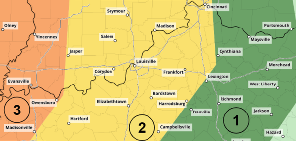
Looking at the Storm Prediction Center's outlook map, a Level 3 "Enhanced Risk" zone covers much of western Kentucky and the Evansville, Indiana area. A Level 2 "Slight Risk" extends east toward Louisville and the surrounding region. Eastern Kentucky falls in a lower risk category, and here's why: the NWS notes that a lack of daytime heating east of I-65 should cause storms to weaken as they push eastward through the night.
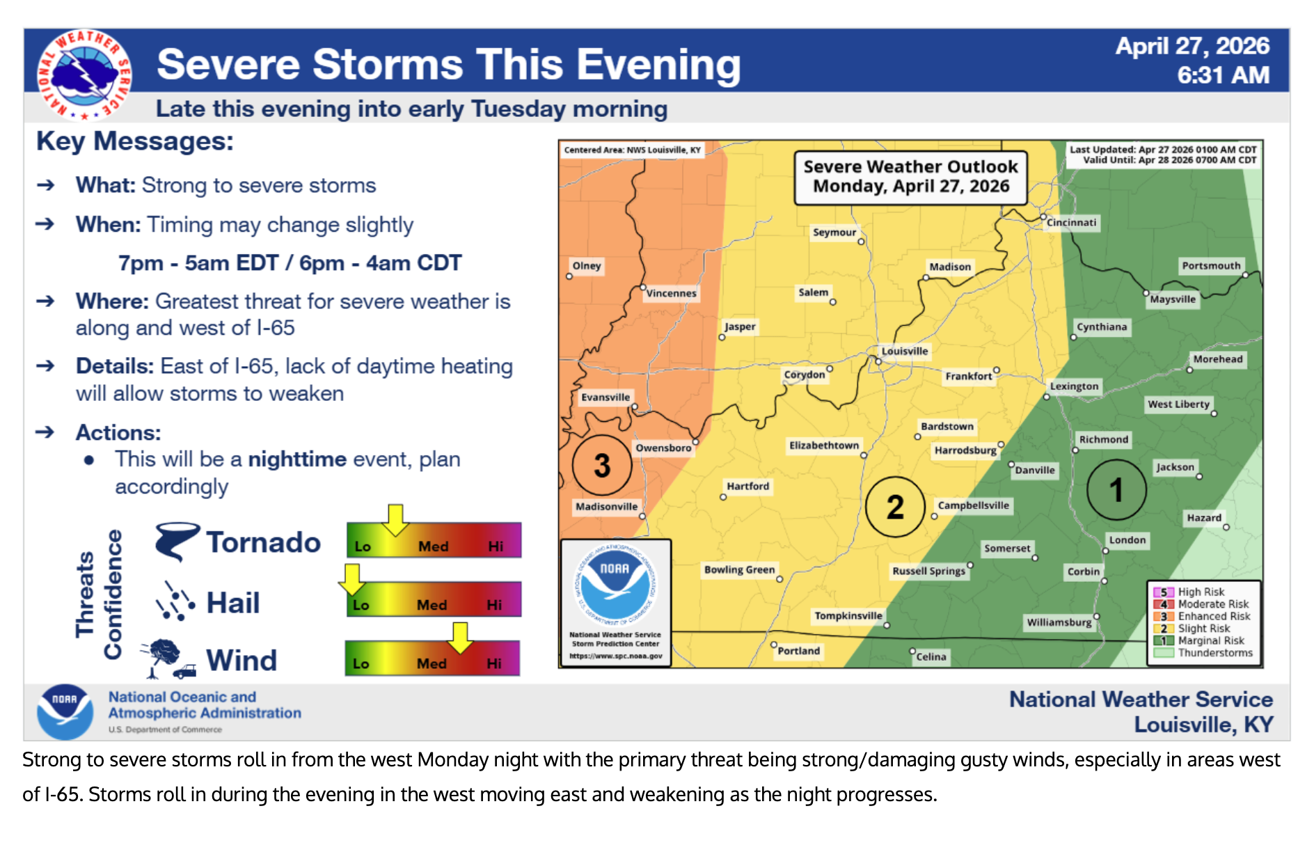
That brings up one of the most critical points forecasters are emphasizing- this is a nighttime event. Severe weather is always more dangerous when people are asleep and potentially unaware. Make sure your phone's wireless emergency alerts are enabled, and consider having a backup way to receive warnings, like a weather radio, especially if you're in the higher-risk western part of the state.
Storms are expected to clear by early Tuesday morning.
Like what you see? Learn more about Shay Informed here! This is honest journalism with compassion and clarity.